
Jack’s Wednesday guest post is actually something of a book review –
The History of The Pound (Rhonda Robertson, Nancy Clark Brown)
Pound is a small town to the north of Big Stone Gap and is sometimes referred to as ‘The Pound’. It’s believed to have gotten its name from one of the surveyors who first mapped the area.
We often receive donations of books into Tales of the Lonesome Pine and this book came in one such box. As I gave it a cursory glance through I realized that it was not only very well written and researched for a privately published book, but it covered a wider area than just the town of Pound.
As I began to check it out more thoroughly I came to a section called ‘aviation in Wise County’. As many of you will know, I’m a sucker for anything to do with airplanes so I was mightily intrigued!
I already knew that one of the streets here in Big Stone Gap is called aviation road and had heard rumors of an airstrip out that way at one time. Here finally was the whole story, and it really is a fascinating one!
The first flight was on 4th July 1913 but the pilot failed to clear trees at the end of the ball park being used and the plane was damaged beyond repair. The first completely successful flight was on June 21st 1915 and was followed by more a week or so later. These also took place at the ball park. It was 1920 before there were more demonstration flights – first at the ball park and then from a farm near East Stone Gap.
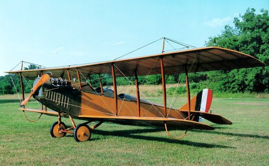
Curtiss Jenny
It was in 1923 that a dedicated permanent airfield was finally established at Big Stone Gap across the river from the ball park, which is exactly where aviation road is today. Once the airfield was operational quite few local people purchased planes – mostly war-surplus ‘Curtiss Jennies’ and British ‘Avros’. Among these owners were some based in the town of Appalachia and they established ‘Cumberland Airways Inc’, buying and refurbishing Jennies and Avros and then re-selling them after testing at the Big Stone Gap airfield. It seems that following this burst of activity the use of the field tapered off and it fell into disrepair and finally was bought by a gentleman who lived close by and didn’t want planes near his house. He required anyone wishing to fly there to get permission from him and there’s no evidence he ever gave it.
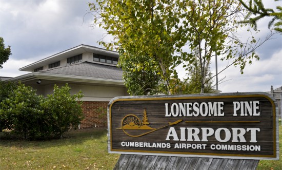
In 1938 a completely new airfield called The Powell Valley Airport was built at Crackers Neck just outside Big Stone Gap and a flying school was established there, closing in 1942 and re-opening in 1945. Following a fire in 1948 it closed for good and flying in the area moved to the town of Wise with the establishment of Lonesome Pine Airport which continues to operate successfully up to the present day.
I wonder if there any traces of the three Big Stone Gap airfields still to be found – – –
